To calculate the difference in local time between Delhi and Bengaluru, we need to focus on the difference in their latitudes since their longitudes are almost the same.
Local time differences are influenced by the Earth’s rotation, with the Earth rotating 15° of longitude per hour. Since the latitudes of Delhi and Bengaluru are at 29°N and 13°N, the difference in latitude is:
- 29°N – 13°N = 16°.
However, latitude does not directly affect the time difference (only longitude does), so the time difference will be primarily affected by longitude. Since the longitudes are very close, the difference in local time will be minimal.
In fact, even though there is a slight difference in latitudes, the time difference due to longitude will be essentially zero because the longitudes are almost identical. Therefore, the local time in Delhi and Bengaluru will be practically the same.
Additional facts
Earth’s Rotation and Time Zones:
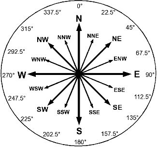
- The Earth rotates 360° in 24 hours, which means it rotates 15° of longitude per hour.
- Each time zone typically spans 15° of longitude, and the local time in each zone is based on its position relative to the Prime Meridian (0° longitude).
- As you move eastward, time increases by 1 hour for every 15° of longitude, while moving westward decreases the time by 1 hour per 15°.
Effect of Latitude on Time:
- Latitude (North or South) doesn’t directly affect local time. Local time is mainly determined by longitude.
- Latitude is the angle from the equator, but time zones are calculated based on the Earth’s rotation around its axis, which relates to longitude.
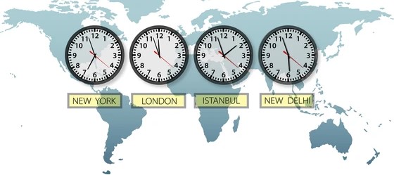
Time Zones in India:
- India follows a single time zone: Indian Standard Time (IST), which is 5 hours and 30 minutes ahead of UTC (Coordinated Universal Time).
- The time zone is largely based on the longitude of 82.5°E, which is roughly in the center of India. This standard time is used across the entire country, despite its geographical span from east to west.
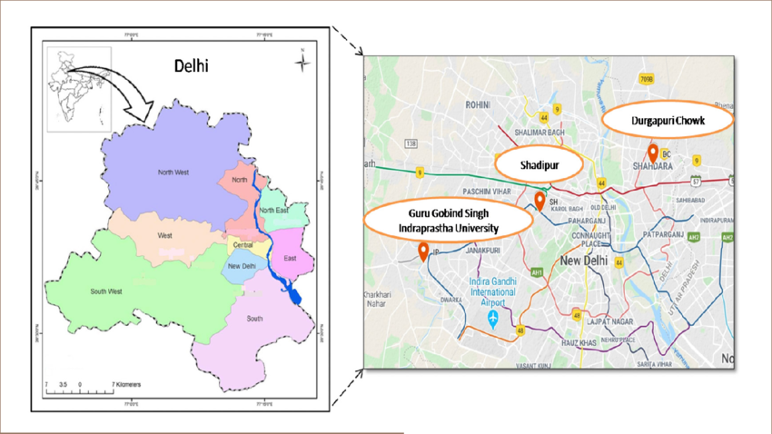
Delhi and Bengaluru’s Longitudes:
- Delhi: Longitude of approximately 77°E, Latitude of 28.6°N.
- Bengaluru: Longitude of approximately 77°E, Latitude of 12.97°N.
- Both cities are nearly on the same longitude (77°E), which means the local time will be the same.
Why Latitude Matters for Climate, Not Time:
- Latitude impacts the climate and weather of a location. Cities closer to the equator (low latitudes) tend to have warmer temperatures, while cities closer to the poles (high latitudes) experience more extreme seasonal changes in sunlight.
- Latitude also affects the length of day and night, especially near the poles, but it doesn’t affect the calculation of local time.
Indian Standard Time (IST):
- Since India follows one time zone, there is no time difference between Delhi and Bengaluru despite their slight latitudinal difference.
- In contrast, countries with larger longitudinal spans, like the United States or Russia, use multiple time zones to account for local time differences across vast geographical distances.
Historical Context:
- Before standardized time zones, cities often set local time based on the position of the sun (solar time), but as railways and telecommunication networks grew, a need for synchronized time was recognized. This led to the creation of time zones to make scheduling and coordination easier.
Global Time Coordination:
- Today, UTC (Universal Time Coordinated) is the global time standard, and time zones across the world are defined relative to UTC (or GMT – Greenwich Mean Time).
FAQs
Local time in a city is primarily determined by its longitude. The Earth rotates 15° per hour, and each time zone spans 15° of longitude. The time adjusts based on how far east or west a location is from the Prime Meridian (0° longitude).
Latitude does not directly affect time. Time differences between locations are caused by differences in longitude, not latitude. Latitude affects climate, weather patterns, and daylight hours but has no impact on local time.
India follows a single time zone, Indian Standard Time (IST), which is 5 hours and 30 minutes ahead of UTC. Despite the country’s vast geographical expanse, India uses a single time zone for political, economic, and logistical reasons to ensure uniformity across the country.
The relationship between time and longitude is that the Earth rotates 15° of longitude every hour. As you move eastward, local time increases by 1 hour for every 15° of longitude, and as you move westward, local time decreases by 1 hour for every 15° of longitude.
Countries with large geographical areas, such as the USA or Russia, use multiple time zones to account for the varying longitudes across their land. Each time zone typically spans 15° of longitude, with the time adjusting based on how far east or west a location is from the standard time zone reference.